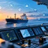
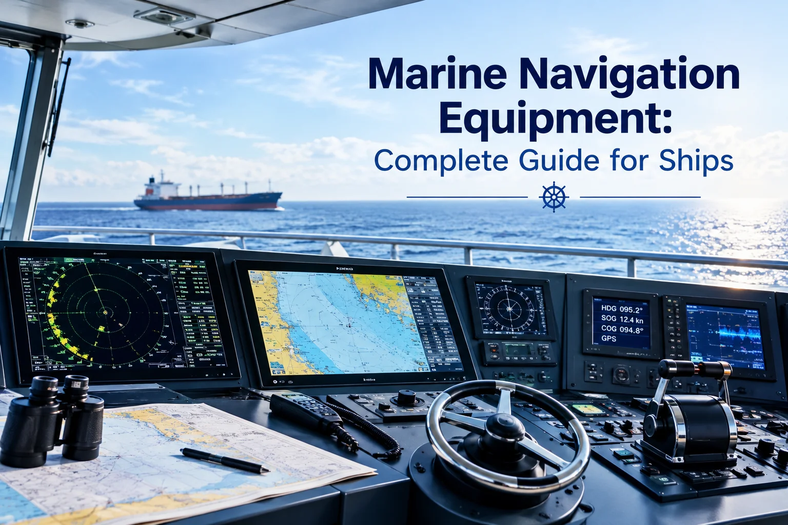
A navigation problem rarely arrives as a neat warning on a screen. Heavy rain can hide a small vessel, a cross-current can push a ship away from its planned track, and a busy port approach can change within minutes. Marine navigation equipment helps bridge teams interpret these conditions and act on reliable information.
Modern ships combine radar, electronic charts, satellite positioning, AIS, heading sensors, depth instruments and steering controls. Each system shows the voyage from a different angle, so the crew needs to compare sources rather than rely on one display.
That need becomes more obvious when vessels operate across different regions. A ship entering Sydney Harbour faces different traffic and weather conditions from one working around the Great Barrier Reef, crossing the North Atlantic or supporting offshore operations near West Africa. Together, these technologies make up modern maritime navigation equipment.
How Marine Navigation Systems Support Crews
A bridge team does not navigate using a single screen. It compares information from several systems and checks whether the overall picture makes sense.
A marine navigation system can combine satellite positioning, radar, electronic charts, heading information and vessel data from AIS. Modern marine navigation systems may also connect several displays and sensors so that operators can compare information without constantly moving between separate instruments.
This becomes important when the vessel’s heading and actual movement differ. A strong coastal current may carry a ship sideways even though its bow remains pointed along the planned course. Position data can reveal the change, while radar and ECDIS provide additional context.
The same principle applies near busy ports. Commercial ships, ferries, fishing boats, pleasure craft and fixed structures may occupy the same area. Marine navigation equipment gives each source a specific role, allowing the bridge team to build a clearer picture instead of treating one instrument as the final authority.
Essential Marine Bridge Equipment Onboard
The configuration of marine navigation equipment depends on vessel size, trading area, bridge layout and the work the vessel performs. Satellite positioning is another key component, with a marine GPS navigation system providing positional data that can be shared with connected bridge systems.
A deep-sea container ship may need a different arrangement from a harbour tug, survey vessel or offshore support vessel. Common bridge technologies include:
- Radar for detecting and tracking surrounding targets.
- ECDIS for electronic charts and route monitoring.
- AIS for exchanging vessel identification and movement data.
- GPS or other satellite positioning equipment.
- Gyrocompass equipment for heading reference.
- Autopilot systems for controlled steering.
- Echo sounders for measuring water depth.
- Marine communication equipment for ship-to-ship and shore contact.
Together, these systems form marine bridge navigation systems, while individual displays, sensors, and controls contribute to the wider marine bridge equipment setup.
The number of systems matters less than how well they work together. A replacement display, for example, may look suitable on paper but create problems if it cannot communicate with existing sensors.
For that reason, ship navigation equipment needs to be assessed as part of the vessel’s wider bridge architecture, not as isolated products.
Radar For Complex Marine Environments
Radar becomes especially valuable when the horizon is no longer reliable. Fog, haze, night operations and heavy tropical rain can make visual observation difficult, while busy coastal waters may contain several targets at once.
Marine navigation equipment based around radar can help operators establish target range, bearing and movement. Modern marine radar equipment may also provide tracking functions that help crews assess how surrounding targets are developing.
The environment still matters. Heavy precipitation can produce unwanted radar returns, while waves can create sea clutter close to the vessel. Small craft may also become difficult to distinguish in rough conditions.
Geography creates another challenge. A vessel entering a narrow channel can receive returns from the coastline, islands, harbour structures and navigation marks while also tracking moving traffic.
A marine radar system therefore works best when its information is compared with AIS, visual observations, chart data and known vessel movement. Radar supports judgement; it does not replace it.
ECDIS For Smarter Route Planning
Electronic charts have changed how crews prepare and monitor voyages. Marine navigation equipment incorporating ECDIS can display the planned route, vessel position and chart information in one working environment.
Its value becomes particularly clear in geographically complicated waters. Reef systems, shallow approaches, narrow channels, traffic separation schemes and restricted areas leave little room for casual route planning.
Depth is another consideration. A vessel’s draught, tide and available under-keel clearance can determine whether a passage is appropriate. The shortest route is therefore not necessarily the most practical one.
Weather can also change the situation. Strong winds, large swells or poor visibility may affect a vessel’s approach to a coastal area even when the planned route remains technically available.
ECDIS marine equipment supports this assessment, but it does not make the navigation decision. Chart data, safety settings, route parameters and relevant warnings still require careful checking by qualified bridge personnel.
AIS And Real-Time Vessel Awareness
AIS gives bridge teams another source of information by exchanging data between participating vessels and shore stations. An AIS marine system may show vessel identity, position, course and speed. In a busy approach, this can help operators match a radar target to a particular vessel.
However, AIS depends on transmitted information. A small craft may not transmit AIS, while another vessel’s data may be incomplete, delayed or inaccurate.
This distinction matters in mixed-traffic areas where commercial vessels share water with fishing boats, recreational craft and workboats. A clear AIS display should never be interpreted as proof that the surrounding water is clear.
Marine navigation equipment becomes more useful when AIS is compared with independent sources. Radar detects targets through reflected signals, visual observation provides direct confirmation, and chart information explains the geographic setting.
Heading And Steering Under Pressure
Position tells the bridge where the vessel is, but heading and steering determine how it is moving through the water. A marine gyrocompass provides heading information that can feed radar, ECDIS, autopilot and other bridge systems. Reliable heading data matters because connected systems use it to interpret vessel movement.
Sea conditions can place additional demands on steering. A following sea may affect directional stability, while strong crosswinds can increase steering corrections. A coastal current can also produce a difference between the vessel’s heading and its track over the ground.
A marine autopilot system can reduce repetitive steering work during suitable open-water operations. It should not be treated as a substitute for watchkeeping, particularly in confined waters, close manoeuvring or changing traffic conditions.
When selecting marine navigation equipment, operators should therefore consider how heading sensors, steering controls and displays exchange information, rather than judging each component independently.
Choosing A Marine Navigation Equipment Supplier
The right marine navigation equipment supplier should begin with the vessel’s working conditions rather than simply recommending the newest available model. For operators managing different vessels, a marine navigation systems supplier can also help maintain compatibility across varied bridge configurations.
Technical teams should consider:
- Trading area: Coastal, offshore, open-ocean and restricted-water operations create different demands.
- Weather exposure: Fog, heavy rainfall, strong winds, swell and extreme temperatures can affect both navigation and equipment.
- Vessel characteristics: Draught, speed, size and manoeuvrability influence equipment requirements.
- Existing infrastructure: New systems must work with installed sensors, displays, power supplies, and data connections.
- Maintenance access: Remote vessels may require stronger spare-parts planning because immediate technical assistance may be unavailable.
- Future upgrades: Suitable interfaces can make later modernisation less disruptive.
Regulatory requirements should also be checked before equipment is specified or replaced. The IMO Safety of Navigation framework covers requirements and performance standards relevant to shipborne navigation systems and equipment.
Older vessels present a particularly practical challenge. A radar, display or sensor may be discontinued while the rest of the bridge remains serviceable. Finding an exact replacement is not always possible, making compatibility and alternative equipment assessment essential.
This is where experienced sourcing becomes more valuable than simply comparing catalogue prices. Marine navigation equipment should be evaluated against installation requirements, technical compatibility, maintenance support and the vessel’s expected service life.
Comparing Key Navigation Technologies
Different systems answer different operational questions, so assess marine navigation equipment based on the information each technology provides. This is particularly important when selecting navigation equipment for ships or planning an upgrade for an existing vessel.
| Equipment | Primary role | Useful information | Practical consideration |
| Radar | Target detection | Range, bearing and movement | Rain and sea clutter affect returns |
| ECDIS | Electronic charting | Route, position and geographic data | Requires suitable chart data and settings |
| AIS | Vessel identification | Identity, position, course and speed | Depends on transmitted information |
| GPS | Positioning | Latitude, longitude and movement | Should be independently cross-checked |
| Gyrocompass | Heading reference | Vessel heading | Accuracy affects connected systems |
| Autopilot | Steering control | Selected heading or track | Requires active monitoring |
| Echo sounder | Depth measurement | Water depth below vessel | Sensor position affects readings |
The systems answer different questions rather than duplicating one another. This distinction becomes important when planning a new bridge or replacing equipment on an older vessel.
For operators comparing navigation equipment for vessels, the choice should also account for integration, operating conditions, service support and the availability of compatible replacement components.
Integration And Maintenance Matter
Modern marine navigation electronics can provide a large amount of information, but more information does not automatically mean better navigation. Marine navigation equipment is most useful when the information it provides remains clear, consistent and easy for the crew to interpret.
A useful bridge presents important data clearly and consistently. If heading, position or target information differs between connected displays, the crew may spend valuable time investigating the discrepancy.
The physical environment also deserves attention. Salt exposure, vibration, humidity and temperature changes can affect electronics, connectors and sensors over time. Vessels operating far from their home ports face an additional logistical problem when they need specialist replacement parts.
For international operators, spare-parts availability should therefore form part of procurement planning. A small discontinued component can create a significant delay if the vessel is waiting at an overseas port.
A supplier with international sourcing capability can help identify compatible alternatives, arrange replacement equipment and support vessels operating away from their normal maintenance base. Good marine communication and navigation equipment planning therefore includes the years after installation, not just the day of purchase.
For vessels requiring broader ship navigation electronics, compatibility between older and newer components should also be confirmed before installation.
Building A Practical Navigation Setup
The most advanced bridge is not necessarily the most useful one. The better question is whether the crew can find, understand and cross-check important information when conditions become difficult.
Imagine a vessel approaching port during heavy rain. Radar may show several returns, AIS may identify some of the traffic, ECDIS may display the channel, and positioning data may show a gradual deviation from the intended track. Each system contributes a different piece of the situation.
Now consider a vessel operating close to offshore infrastructure with strong wind and current. Close-range target awareness, dependable heading information and predictable steering may matter more than adding another display.
Marine bridge navigation systems should therefore be selected around real operating risks. Weather, geography, traffic density, vessel characteristics, maintenance access, and crew workflow all deserve attention before specifying equipment. The right marine navigation equipment should support that environment without adding unnecessary complexity.
This approach also helps operators assess vessel navigation equipment according to actual operating requirements rather than selecting equipment simply because it has more features.
Conclusion
Reliable navigation comes from combining accurate information with equipment that suits the vessel and its operating environment. Radar, ECDIS, AIS, positioning, heading, steering, depth and communication systems each provide a different layer, while weather, geography and vessel behaviour determine how that information should be interpreted. Marine navigation equipment is most effective when these elements are properly integrated and maintained.
If you are sourcing equipment for a new bridge installation, replacement requirement or vessel upgrade, contact Sacred International to discuss your requirements and explore suitable solutions for your operation.
Frequently Asked Questions
1. What does marine navigation equipment include?
Marine navigation equipment can include radar, ECDIS, AIS, GPS, gyrocompass, autopilot, echo sounder and communication systems. The exact combination depends on vessel type, trading area, bridge configuration and operational requirements.
2. Why is marine radar equipment important?
Marine radar equipment is an important part of marine navigation equipment because it helps crews detect and monitor surrounding targets when visibility is reduced, or visual identification becomes difficult, particularly during fog, heavy rain and night operations.
3. Can AIS replace radar on a ship?
No. AIS and radar provide different information. Marine navigation equipment using both technologies allows bridge teams to compare transmitted vessel information with independently detected targets, providing a broader picture of surrounding traffic.
4. How does weather affect ship navigation?
Weather can reduce visibility, increase steering demands and alter vessel movement through wind, waves and currents. Heavy rain can also affect radar displays, making marine navigation equipment an important source of information when conditions become difficult.
5. What should I consider when buying navigation equipment?
Consider vessel type, trading routes, weather exposure, bridge compatibility, crew workflow, maintenance requirements and spare-parts availability. The right marine navigation equipment should suit the vessel’s actual operating conditions rather than offer more features.
6. Why does equipment integration matter?
Integration allows information from different sensors and systems to reach the displays and controls that need it. When marine navigation equipment is properly integrated, crews can compare position, heading and target information more efficiently and identify inconsistencies sooner.